18S.20.040 Conservancy Shoreline Environment Designation (SED).
The intent of the Conservancy SED is to conserve and manage existing natural resources and valuable historic and cultural areas while providing recreational benefits to the public and while achieving sustained resource utilization and maintenance of floodplain processes. Shoreline ecological functions should be preserved by avoiding development that would be incompatible with existing functions and processes, locating restoration efforts in areas where benefits to ecological functions can be realized, keeping overall intensity of development or use low, and maintaining most of the area's natural character.
A. Designation Criteria. The Conservancy designation applies to shoreland areas that meet one or more of the following criteria:
1. The shoreline is currently supporting lesser-intensity resource-based uses, such as agriculture, forestry, or recreational uses, or is designated agricultural or forest lands pursuant to RCW 36.70A.170;
2. The shoreline is currently accommodating low density residential uses;
3. The shoreline is supporting human uses but is subject to environmental limitations, such as properties that include or are adjacent to steep banks, feeder bluffs, or floodplains or other flood-prone areas;
4. The shoreline is of high recreational value or with unique historic or cultural resources; or
5. The shoreline has predominantly low-intensity water-dependent uses.
6. Shoreline areas appropriate and planned for development that is compatible with maintaining or restoring of the ecological functions of the area, that are not generally suitable for water-dependent uses and that lie in urban growth areas, or commercial or industrial "limited areas of more intensive rural development" if any of the following characteristics apply:
a. They are suitable for water-related or water-enjoyment uses;
b. They are open space, floodplain or other sensitive areas that should not be more intensively developed;
c. They have potential for ecological restoration;
d. They retain important ecological functions, even though partially developed; or
e. They have the potential for development that is compatible with ecological restoration.
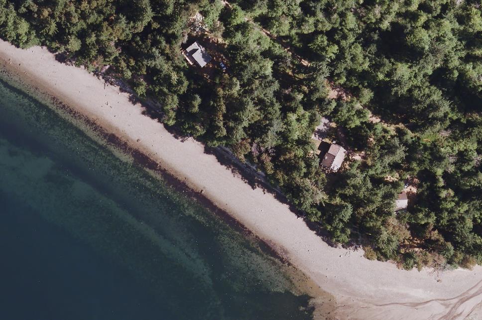
FIGURE 18S.20-2 –
Example of Conservancy Shoreline Environment
B. Management Policies.
1. Active and passive outdoor recreation activities and resource-based uses such as timber harvesting, aquaculture, and passive agricultural uses such as pasture and range lands shall receive priority.
2. Opportunities for ecological restoration should be pursued, giving priority to the areas with the greatest potential to restore ecosystem-wide processes (the site of naturally occurring physical and geologic processes of erosion, transport, and deposition; and specific chemical processes that shape landforms within a specific shoreline ecosystem and determine both the types of habitat and the associated ecological functions) and functions.
3. Development should be limited to that which sustains the shoreline area's physical and biological resources and temporary uses that do not substantially degrade ecological functions or the natural character.
4. Agriculture, forestry, and aquaculture should be allowed.
5. Mining, as a unique use due to its inherent relationship to geology, may be an appropriate use when conducted in a manner consistent with the Conservancy SED, and located consistent with mineral resource lands' designation criteria pursuant to applicable provisions of the Growth Management Act, RCW 36.70A.170, and WAC 365-190-070.
6. Water-dependent and water-enjoyment recreation facilities that do not deplete the resource over time, including but not limited to boating facilities, angling, hunting, wildlife viewing trails, and swimming beaches, may be allowed.
7. Commercial and industrial development should be limited to water-oriented commercial and industrial development in instances where those uses have been located there in the past, or at unique sites that possess shoreline conditions and services necessary to support the development.
8. Outstanding recreational or scenic values should be protected from incompatible development.
C. Maps. Conservancy Shoreline Environment Designation maps are found in Chapter 18S.70 PCC – Appendix F.